 |
 |
|
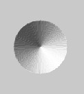
A heightmap is a convenient way of storing a terrain for a computer program to use. It is a picture that uses the colour at each pixel to define the height of the terrain at that point, which can then be used to generate a three-dimensional model in the right program. Below is an example of heightmaps and how they may be used.
|
|
|
The leftmost image is the heightmap, it is defining a small pointed hillock.
The middle image is taken from Geoscape3d and shows the heightmap lit from a light source in the south-east corner. This can give better visual feedback than the unlit version.
The final image shows how Geoscape3d uses the heightmap to create a three-dimensional terrain.
All the terrain building features of Geoscape3d work on heightmaps. See tools.
